Changing rural practice and the biographies of buildings


Second Edition OS map 1896 showing extension to byre reproduced Reproduced with the permission of the National Library of Scotland http://maps.nls.uk/index.html
The extension was probably required due to the increasing need for storage for winter hay feed as dairy herd sizes increased, and can be seen in both map evidence and the building architecture of the farm.

Change in stonework shows where new extension (right) was keyed into the original byre
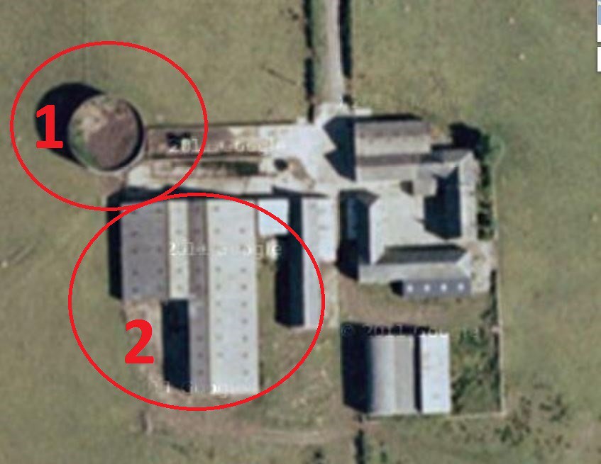
Modified from Google Maps
https://www.google.co.uk/maps/@55.7798867,-5.0849112,622m/data=!3m1!1e3
Similar evidence of expansion can be seen on Google Earth images which show how later silage pits and slurry tanks were introduced as winter feed moved from hay to silage in the 1970's (1) and increasing herd sizes demanded ever larger cow sheds (2).


For many, dairy farming became unsustainable. For those who remained the economic conditions demanded increasing economies of scale. As a result an increasing number of traditional island farms became untenanted, whilst milk price instability has moved Bute dairy farming towards an ever more economically precarious position.

This has forced new thinking about how built heritage and landscape are used to help sustain rural communities:
'Ambrismore, near Scalpsie Bay, where an existing stone byre will be converted to a four-bedroom family home and three new build homes will form a cluster of energy-efficient dwellings for rent.'
The Buteman 18th Feb 2014
